Recent searches
Search options
#ogc
0 posts0 participants0 posts today
Continued thread
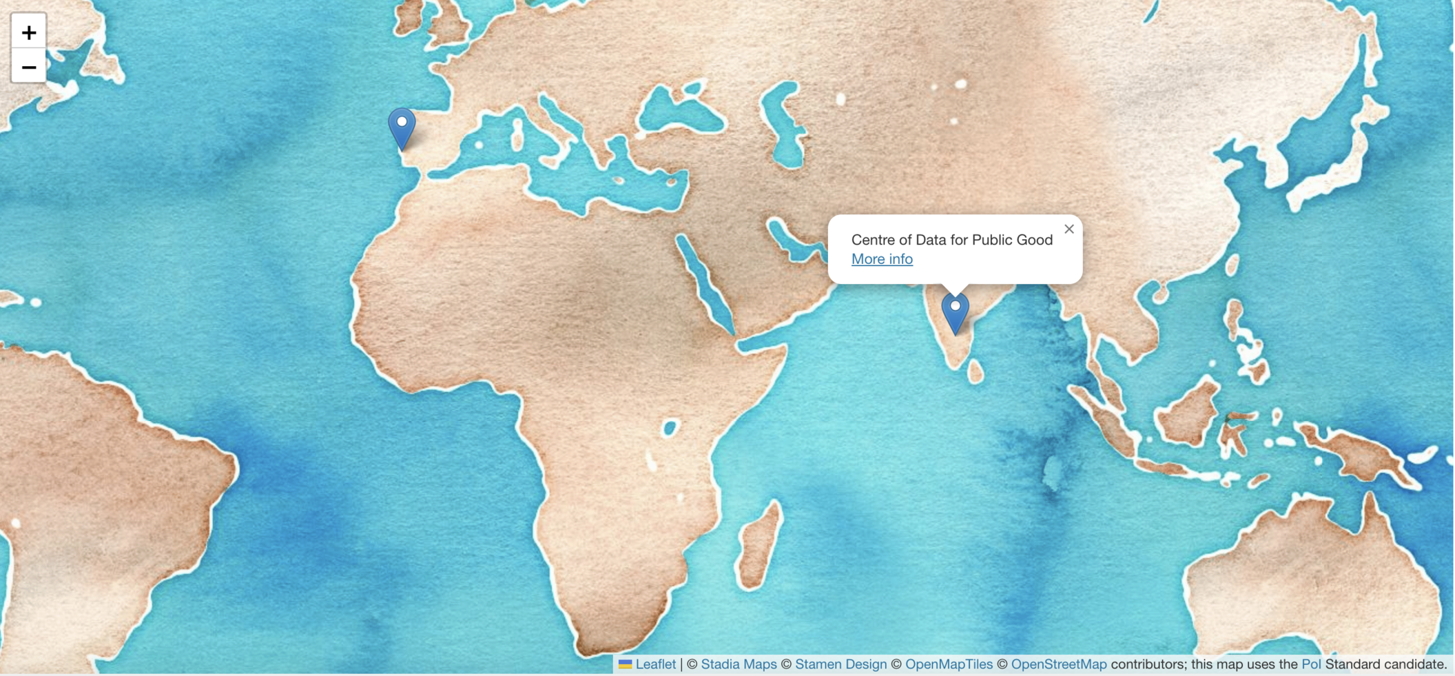
We connected with our fellow sprinters at the Indian node at Bangalore, who are several hours ahead of us! (: #cdpg #sprint #standards #ogc
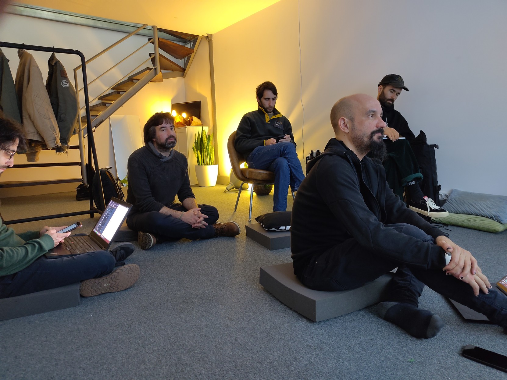
We have started the #codesprint25 here at the Lisbon node, with some croissants! :) #ogc #ogcapi #standards #sprint #arts&nerds

**geometa** provides an essential object-oriented data model in R, enabling users to efficiently manage geographic metadata.
The package facilitates handling of ISO and OGC standard geographic metadata and their dissemination on the web.
In this interview, we speak with **Emmanuel Blondel**, the author of geometa, ows4R, geosapi, geonapi and geoflow—key R packages for geospatial data management.
https://r-consortium.org/posts/exploring-geometa-an-r-package-for-managing-geographic-metadata/

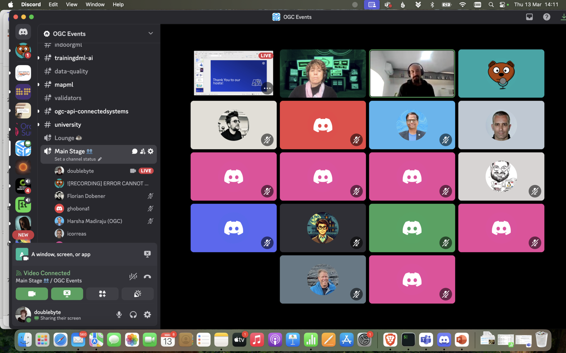
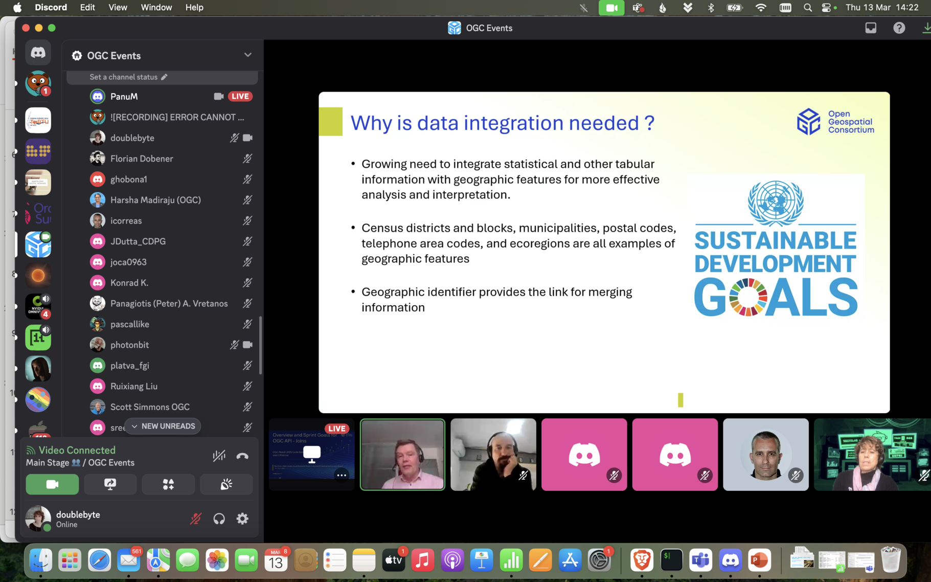
Today, we have kicked-off the #OGC Open Standards Code Sprint, with the pre-event webinar, where we heard about the sprint goals of OGC - API Joins, TrainingDML-AI and OGC API - Records :-) See you in two weeks for the sprint  https://developer.ogc.org/sprints/25/ #CODESPRINT25 #OGCAPI #Standards #hybrid #discord

My usual ranting against #OGC (you love it right ? My number of subscribers jumps every time. Is there a point where I actually earn money, or should I make YouTube videos  ) So I just lose another 1.5 h attending a CRS SWG meeting where PROJJSON pros/cons were re-ashed vs a "conceptual model" compliant hypothetical CRS JSON. Obviously no decision was taken. Postponed to the Greek calends, aka next TC meeting. #protip If you want to be part of a standard group, make sure you are an immortal

 Rejoignez GISCAN – Développeurs & Spécialistes SIG recherchés !
Nous recrutons des experts en SIG et développement Web GIS pour un projet d’envergure.
#SIG #OGC #PostGIS #QGIS #WebGIS #Geospatial #Python
--- Join GISCAN – We’re Hiring GIS Developers & Specialists!
We are looking for GIS and GIS development experts to join our team for an exciting project!
 Apply now by sending your CV and cover letter to contact at giscan dot com or reach out to us on LinkedIn.
https://www.linkedin.com/posts/giscan_sig-ogc-postgis-activity-7301207942739939328-RXxE
www.linkedin.comGISCAN on LinkedIn: #sig #ogc #postgis #qgis #webgis #geospatial #docker #python #metadata…🌍 Rejoignez GISCAN – Développeurs & Spécialistes SIG recherchés ! 🚀
Nous recrutons des experts en SIG et développement Web GIS pour un projet d’envergure.
🔹 Profils recherchés :
✔️ Maîtrise du logiciel QGIS et de la gestion des données spatiales
✔️ Bases solides en Python, SQL, JavaScript, CSS et HTML
✔️ Expérience avec GeoServer, PostgreSQL/PostGIS, OpenLayers, Leaflet ou QGIS Server
✔️ Bonne connaissance des services Web cartographiques (WMS, WFS, WCS)
✔️ Compétences en déploiement serveur (Cloud, Proxmox, Docker, Singularity, Kubernetes) appréciées
✔️ [Optionnel] Expérience en acquisition de données terrain (Drone, GPS, capteurs IoT)
✔️ [Optionnel] Connaissance des métadonnées (ISO 19115, ISO 19139)
📍 Lieu : Maurice (Télétravail ou hybride possible)
📅 Durée : 1 an, avec possibilité de prolongation
🔹 Pourquoi nous rejoindre ?
✨ Un projet stimulant dans un domaine innovant
💡 L’opportunité de travailler avec les dernières technologies SIG
🌎 Un environnement de travail flexible et dynamique
👉 Passionné(e) par le SIG et les nouvelles technologies ? Rigoureux(se) et prêt(e) à relever des défis ? Nous voulons vous rencontrer !
📩 Postulez dès maintenant en envoyant votre CV et lettre de motivation à contact at giscan dot com ou contactez-nous sur LinkedIn.
#SIG #OGC #PostGIS #QGIS #WebGIS #Geospatial #Docker #Python #Metadata #Cloud #Télétravail #Recrutement
—
🌍 Join GISCAN – We’re Hiring GIS Developers & Specialists! 🚀
We are looking for GIS and GIS development experts to join our team for an exciting project!
🔹 Who we’re looking for:
✔️ Proficiency in QGIS and spatial data management
✔️ Solid skills in Python, SQL, JavaScript, CSS, and HTML
✔️ Experience with GeoServer, PostgreSQL/PostGIS, OpenLayers, Leaflet, or QGIS Server
✔️ Strong understanding of web mapping services (WMS, WFS, WCS)
✔️ Knowledge of server deployment (Cloud, Proxmox, Docker, Singularity, Kubernetes) is a plus
✔️ [Optional] Experience in field data acquisition (Drones, GPS, IoT sensors)
✔️ [Optional] Understanding of metadata standards (ISO 19115, ISO 19139)
📍 Location: Mauritius (Remote or hybrid work possible)
📅 Duration: 1 year, with possible extension
🔹 Why join us?
✨ Work on a cutting-edge and impactful project
💡 Opportunity to use the latest GIS technologies
🌎 A flexible and dynamic work environment
👉 Are you passionate about GIS and technology? Detail-oriented and eager to take on new challenges? We’d love to hear from you!
📩 Apply now by sending your CV and cover letter to contact at giscan dot com or reach out to us on LinkedIn.
#GIS #OGC #PostGIS #QGIS #WebGIS #Geospatial #Docker #Python #Metadata #Cloud #RemoteWork #Hiring
A reminder that registrations are open for the March 2025 Open Standards Code Sprint: an #hybrid #NotOnlyCode event, with nodes in Portugal and India. #OGC #standards #geospatial #FAIR #interoperability #hacking https://developer.ogc.org/sprints/25/
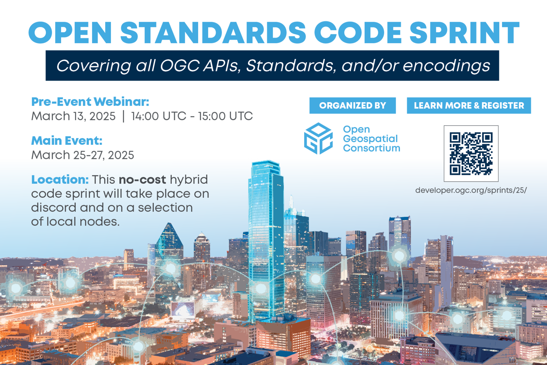
Next OGC Code Sprint will be hybrid, with the option to attend the sprint 100% online, or from one of the local nodes  https://developer.ogc.org/sprints/nodes/#CODESPRINT25 #Hackfest #standards #OGC #geo
Replied in thread
@eldang I don't believe you. That's one of the many misconceptions about NaN that #OGC is rightfully fighting against : http://t20-gimi-ogc-006ced09c39758532bebec9d5488fca26bed7198a2d3b1481b.pages.ogc.org/documents/D013/document.html#Geomatys_contribution_misconceptions_about_NaN
t20-gimi-ogc-006ced09c39758532bebec9d5488fca26bed7198a2d3b1481b.pages.ogc.orgOGC Testbed 20: GIMI Lessons Learned and Best Practices Report
Continued thread

2/2 The #SDWWG not only aims to develop and maintain #SemanticWeb specifications, but to do so in close coordination and collaboration with the #OGC.
See you in some work session.
mastodon.socialMastodon
1/2 The Spatio-Temporal Data on the Web Working Group (#SDWWG) of the World Wide Web Consortium (#W3C) was recently re-chartered. The next two years I will be co-chairing this group with Rob Atkinson (#OGC).
There is a great deal brewing up in the #GeoSemantics space, to name just a few:
- #SOSA 2.0
- #GeoDCAT
- #WebVMW
- An #Ontology for Coordinate Reference Systems (#CRS)
- A #3D extension for #GeoSPARQL
Join in!
https://lists.w3.org/Archives/Public/public-sdw-wg/2025Feb/0002.html
lists.w3.org(Fwd) Call for Participation: Spatio-temporal Data on the Web Working Group Charter approved; Join the Spatio-temporal Data on the Web Working Group from Coralie Mercier on 2025-02-06 (public-sdw-wg@w3.org from February 2025)


Recently, someone mentioned #STAC as a general purpose geodata catalog (not just for imagery but also vector). Is that a thing? And even if it is possible, is it a good idea?
Replied in thread
@nikitonsky
And for the people dealing with geospatial data there is always the fun with #OGC web services like WMS which “traditionally“ report an error with HTTP 200 and some XML describing the error :-/
Following on from the new OWSLib release, it looks like http://wms.jpl.nasa.gov/wms.cgi used in the example is no longer online.
The NEO Web Mapping Service (WMS) will also be taken offline in "early 2025" https://neo.gsfc.nasa.gov/blog/2024/08/30/neo-wms-web-mapping-service-deprecation-alert/
Any suggestions of #WMS servers to use for the example? #gis #osgeo #ogc
New release of OWSLib now available! https://github.com/geopython/OWSLib/releases/tag/0.32.1
PyPI https://pypi.org/project/OWSLib/
OWSLib provides a common API for accessing service metadata and wrappers for numerous Web Service interfaces.
#python #geospatial #python #OGC #foss4g #osgeo 


Continued thread
This major breakthrough calls for several actions:
- addition of corresponding Geometry ST_MovingSofa(corridorSkeleton: Geometry, corridorWidth: double) function in OGC SimpleFeatures Access, and implementation in GEOS and @postgis
- creation of a #OGC Moving Sofa Working Group to federate initiatives around moving sofa problems. #IKEA, #LesDemenageursBretons and #U-Hall are kindly invited to sponsor this initiative.

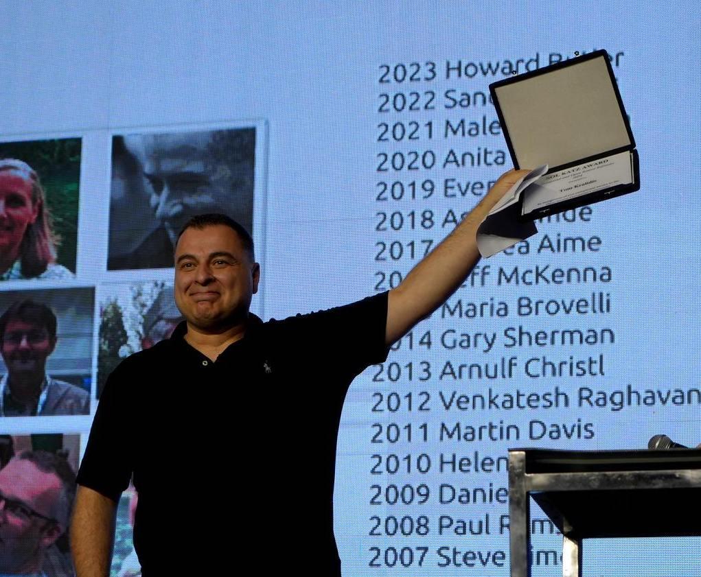
We are honoured to announce that Tom Kralidis is the recipient of the
2024 Sol Katz Award presented on 6 December 2024 at #FOSS4G2024 in Belém, Brazil.
You may know Tom through his activities within the #GeoPython community. Tom also plays a critical role in promoting #OGC standards, throughout FOSS4G projects and connecting the OGC +
#OSGeo communities. He is active in the OSGeo Board & committees.
Read more about Tom Kralidis & the award https://www.osgeo.org/foundation-news/tom-kralidis-receives-the-2024-sol-katz-award/ #FOSS4G